Track your route with complete privacy — even without signal. Yoruk is a lightweight, privacy-first offline GPS tracker for outdoor, emergency, and tactical use.
"Yörük" means nomad in Turkish — one who roams the land freely, just like this app helps you move independently and safely, even offline.
Support & Contact
Email: yoruk.support@protonmail.com
Offline GPS Tracker with Compass and Maps
Yoruk uses only your iPhone’s GPS and compass sensors to track your path. Whether you're hiking, sailing, biking, or in an emergency, it helps you return to your starting point — no internet or signal needed.
The latest version adds offline map support, giving you visual context for your journey. This makes orientation easier in remote areas.
Key Features
- Fully Offline: GPS-based tracking without internet or mobile signal.
- Offline Maps: Built-in detailed maps for terrain awareness.
- Compass Integration: Uses your compass when still, and GPS heading when in motion.
- Accurate Path Tracking: Visualizes your path on screen as you move.
- Distance to Start: Shows how far you are from where you began.
- Scale & Accuracy: Dynamically scales with zoom and shows GPS accuracy.
- Battery-Efficient: Minimal UI optimized for long-term use.
- Private by Design: No data leaves your device. No tracking, no analytics, no ads.
Use Cases
- Hiking, trekking, mountaineering, camping, bushcraft
- Cycling and motorbiking in off-grid areas
- Search and rescue operations
- Disaster zones and emergency evacuations
- Military or tactical operations
- Sailing, shepherding, and nomadic travel
- Preppers, survivalists, and EDC users
In-App Screens and Explanations
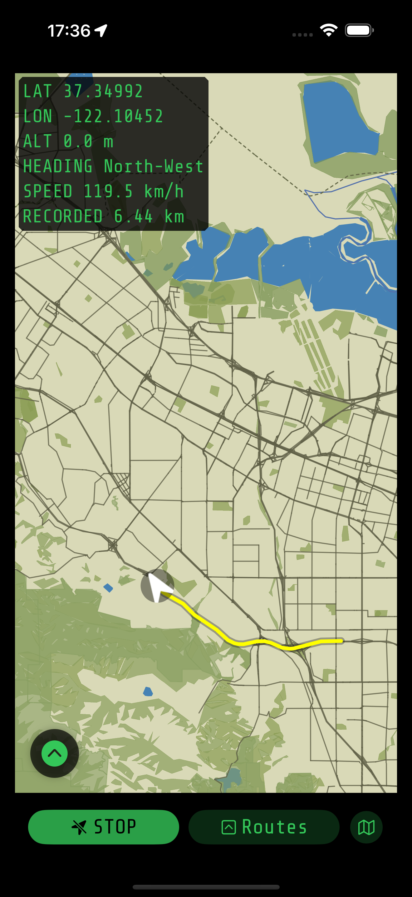
Track Your Route
Your path is recorded from the moment you start. You can always return to your starting point later. (See it under the Routes section.)
- LAT, LON: Your current GPS coordinates.
- ALT: Altitude based on GPS.
- HEADING: Direction based on recent GPS signals. Works reliably even if the compass is miscalibrated.
- SPEED: Your speed, calculated from GPS movement.
- RECORDED: Total distance covered since recording started.
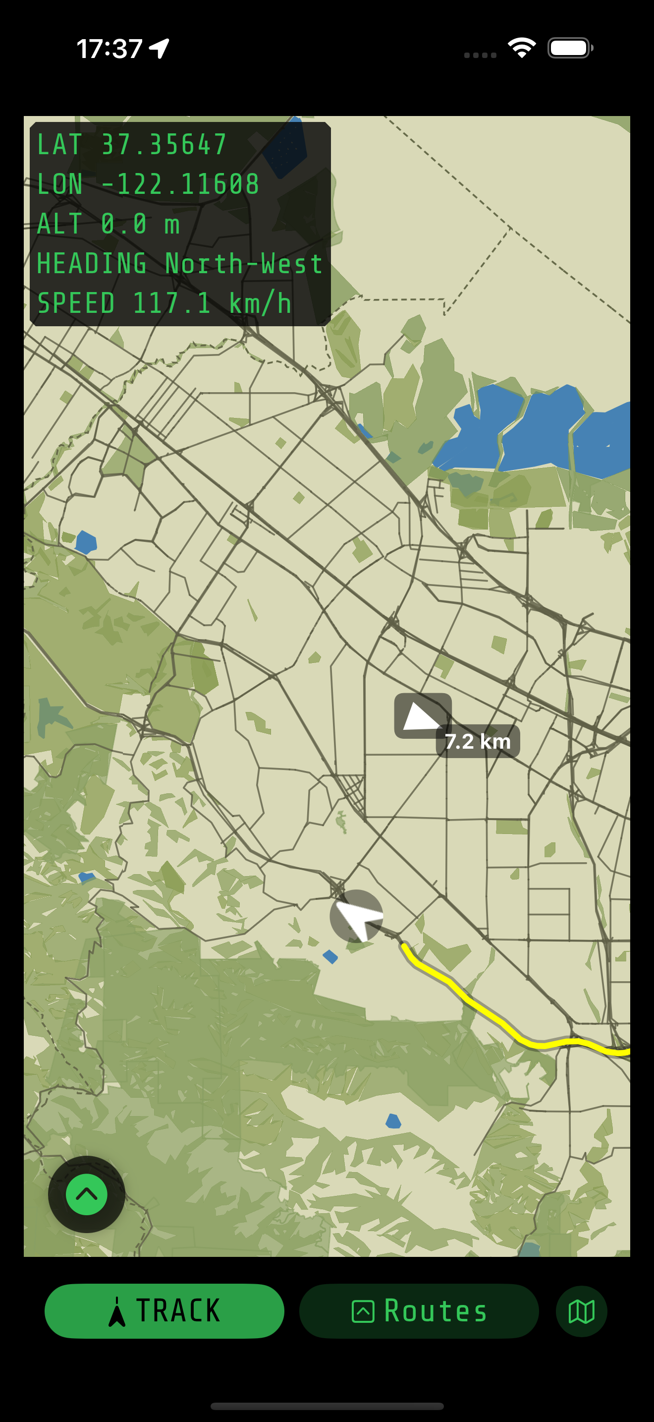
Navigate to a Saved Route
When you select a previously saved route, the app will display its location on the map and guide you with direction and distance information to reach it.
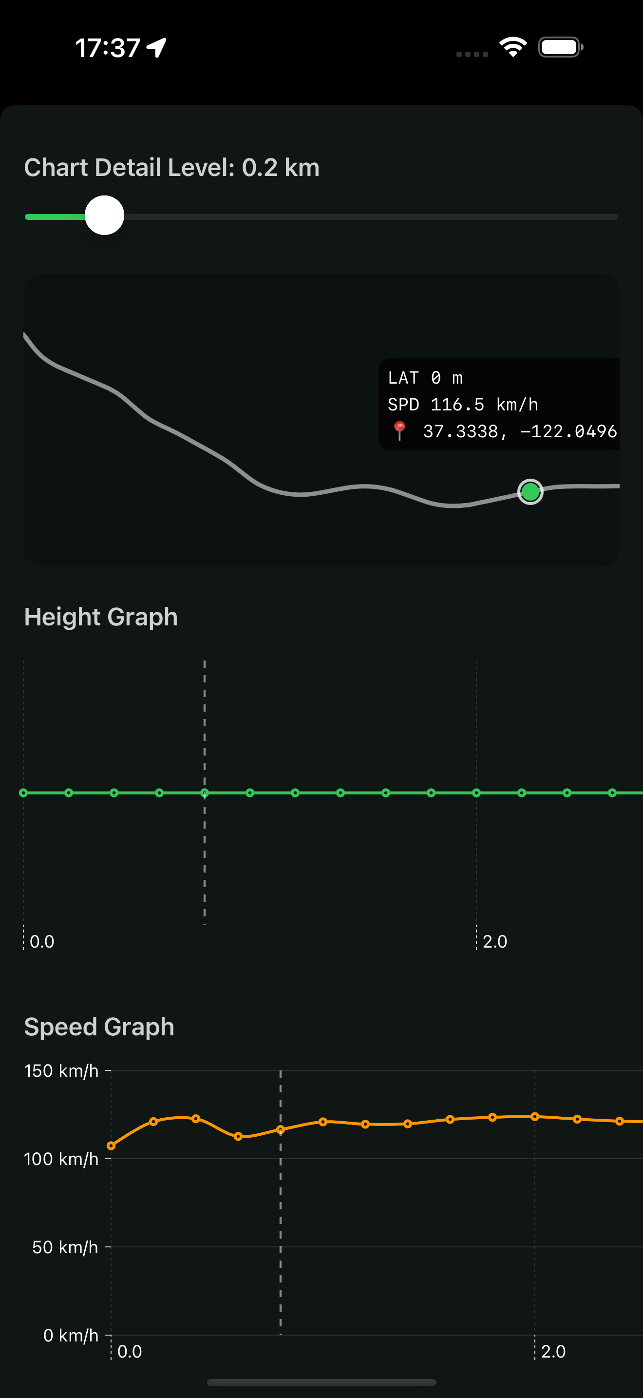
Route Statistics
Accessible from the Route Statistics screen, you can review elevation and speed data recorded along the route — all visualized with location markers.
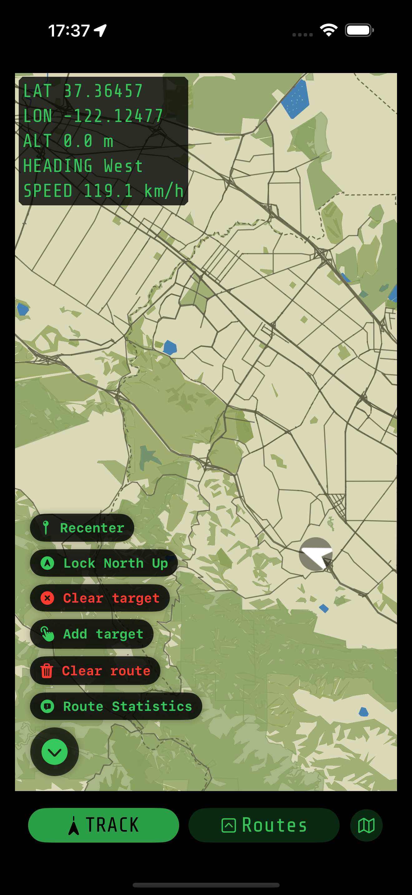
Map Controls Menu
- Recenter / Free Roam: Toggle between centering the map on your location or freely exploring it.
- Lock North Up: Lock the map's orientation to north or let it rotate with your direction.
- Add Target: Tap on the map to set a target. The app shows the direction and distance from your current location to that point.
- Clear Route: Clears the currently visible route from the map.
Offline GPS for Critical Situations
Even in complete signal blackouts, you can rely on Yoruk’s route history and map view to find your way back. Perfect for:
- Natural disasters or war zones
- Mountains, forests, deserts, or at sea
- Anyone who values privacy and self-reliance
Why Choose Yoruk?
- No mobile or internet dependency
- Full offline map support added
- True digital privacy — no hidden tracking
- Lightweight and fast — built for everyday carry (EDC)
Yoruk is your trusted offline GPS navigation app when everything else stops working.